We provide end-to-end data solutions for agricultural product development
Integrated field-to-cloud data management tailored for:
Small Plot Research

On-Farm Trials
Technical Sales Support
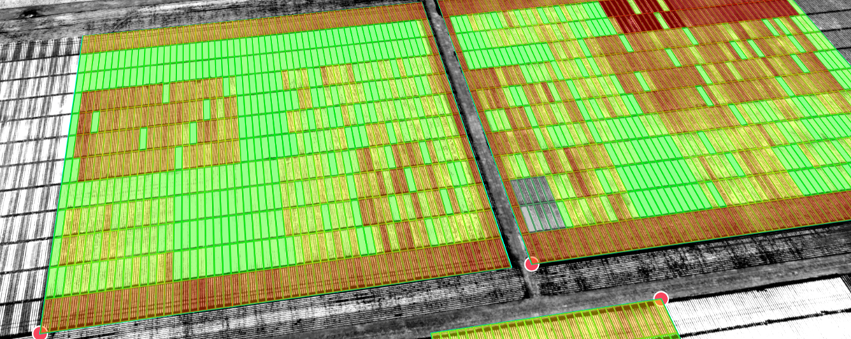
Small Plot R&D: A proven data platform for global field trial programs
Since 2018, aerialPLOT has delivered high-resolution drone imagery to support US field research.
We are self-funded and growing, while others have exited the space. Our value proposition speaks for itself.
UAV Imagery Capture
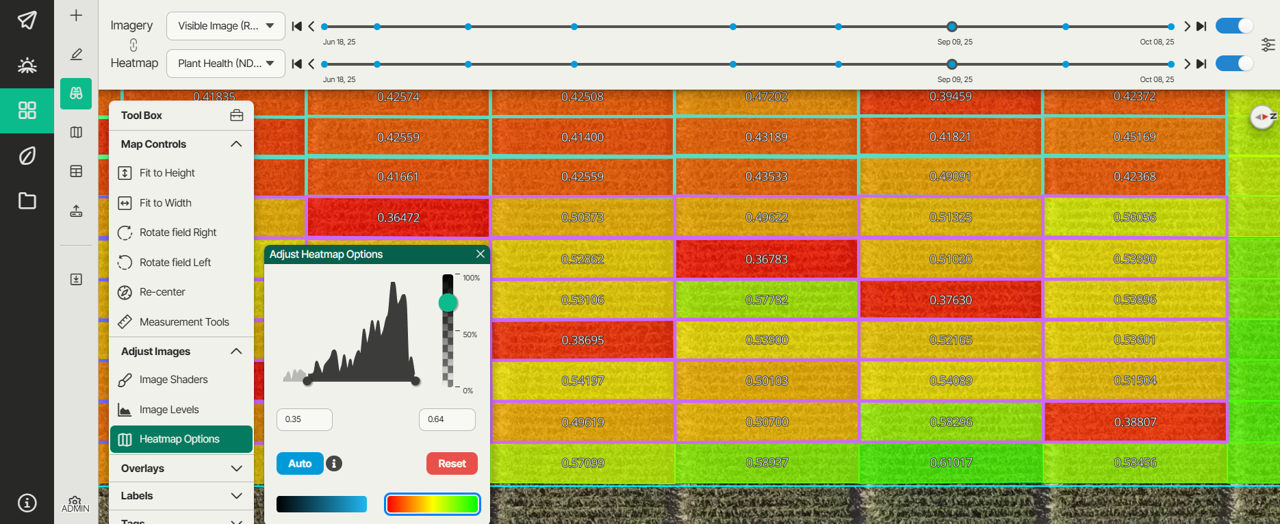
Plot-based Analytics & QC
Growth Modeling & Digital Phenotyping
Data Sharing, Statistics, & Reporting
Grower trials: Product performance insights for farmgate success
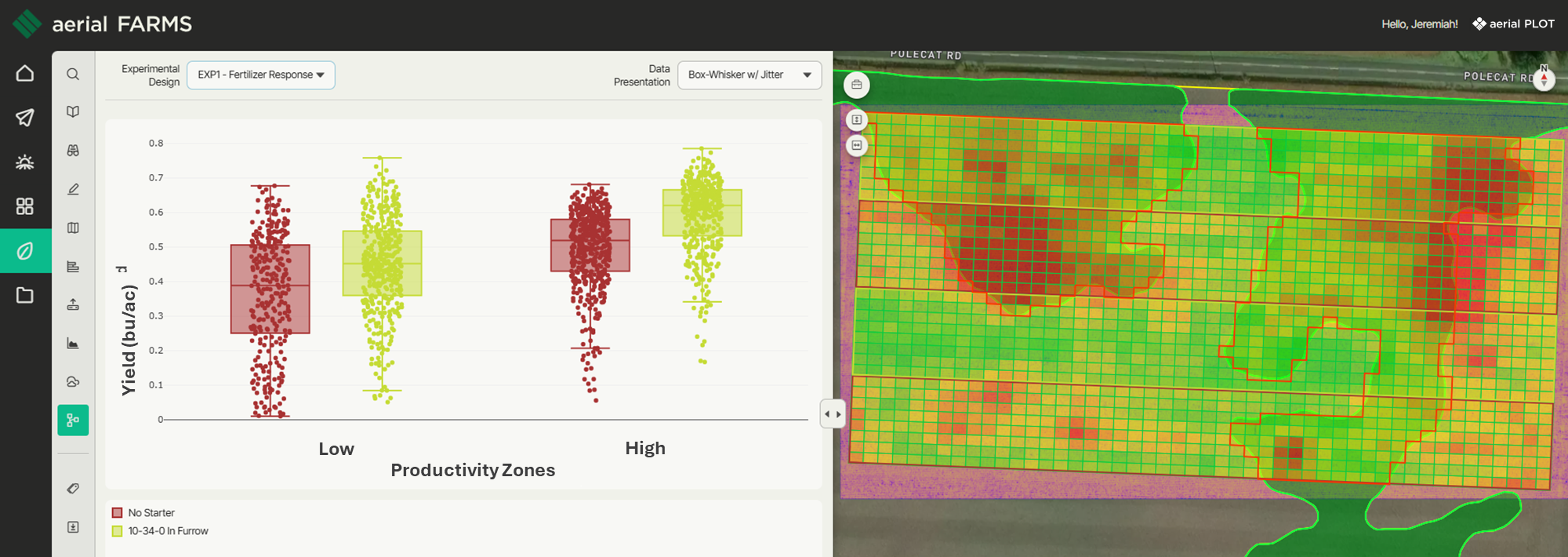
We provide the practical, scalable integration of geospatial analytics to grower trials.
Our system automates insight generation.
We focus on solutions rather than promises.
Stack scalable data layers to build the tools that power insight models
Grower Coordination
UAV and Satellite Imagery Fusion
Multi-layered Geospatial Analytics
Predictive Modeling for Product Success
Interested in learning more?
Reach out to our team for a demo of our platform and to find out how aerial PLOT can help your research teams drive to reliable data-based decisions.